Circulation and Mobility
The Circulation and Mobility Element presents the approach to transportation, addressing access and mobility within the city. The chapter provides a roadway classification system, corresponding cross-sections, and recommended future networks for motor vehicles, walking, biking, riding transit, and the movement of freight. Goals, policies, and actions provide a framework for advancing health and safety, access to services and opportunities, sustainability, and economic vitality through transportation.
For additional information regarding this element, please contact:
Chapter Highlights
Complete Streets refer to the design of streets that allow for all people including pedestrians, bicyclists, motorists, and transit riders of all ages and abilities to safely access and use streets.
Palmdale's unique setting offers many planned regional investments and local transportation innovations. The Circulation and Mobility Element aims to support new and emerging mobility innovations, while aligning regional and local projects with the City’s vision.
Learn About
Goals and Policies
Learn About

Circulation and Mobility
CM-1.1 Roadway design. Design and maintain the public right-of-way through a complete streets approach that facilitates safe, comfortable, and efficient travel for all roadway users.
CM-1.2 Modal conflicts. Use a systemic safety approach to proactively identify opportunities to improve safety where conflicts between users exist.
CM-1.3 Network gaps. Identify and program mitigation measures for gaps and deficiencies in the transportation system to accommodate each major transportation mode.
CM-1.4 Speed management. Include speed reducing elements along local and connector roadways and within all new private development projects.
CM-1.5 Railroad crossings. Implement grade separation at railroad crossings where feasible.
CM-2.1 Roadway classification. Classify streets based on their modal purpose and land use context.
CM-2.2 Multimodal travel. Prioritize safety, operations, and comfort for active and transit modes on streets that have been identified as part of the multimodal network.
CM-2.3 Intersection Design. Prioritize safety and mobility for non-motorized modes in all intersection designs.
CM-2.4 Network connectivity. Prioritize multimodal infrastructure that connects existing development with future infill development areas (i.e., gap closure projects).
CM-2.5 Multimodal comfort. Prioritize quality of multimodal facilities with respect to a user’s experience of stress, connectivity, and safety for streets with a non-automobile priority, and ensure the appropriate balance with vehicular operations.
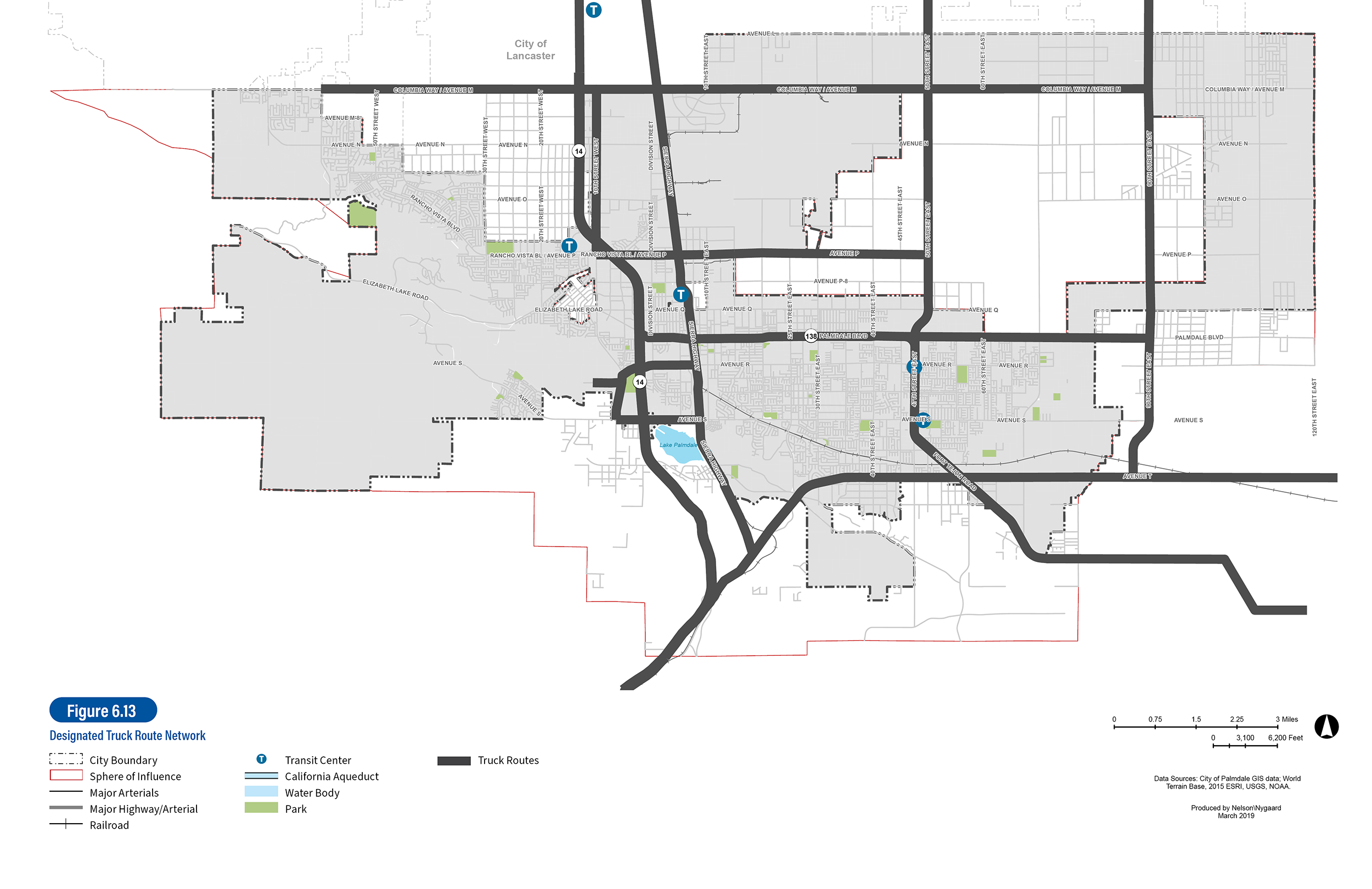
CM-2.6 Managing truck travel. Review the truck route network periodically and update as necessary to minimize impacts on residential neighborhoods while accommodating needs of commercial/industrial uses.
CM-2.7 Travel demand forecasting. Develop and maintain a traffic demand model based upon the designated network, using existing and projected levels to inform land use decisions.
CM-2.8 Growth management. Ensure that the cumulative and regional impacts of new development on the circulation system are mitigated to the extent feasible, concurrent with development. Concurrent shall mean that required facilities are installed as needed during various stages of development.
CM-3.1 Transit reliability. Make public transit a convenient and reliable option for daily trip making on a local and regional basis.
CM-3.2 Transit access. Encourage investments and Capital Projects that reduce first/last-mile barriers to transit stops.
CM-3.3 Access to employment. Encourage investments and Capital Projects that improve the safety and multimodal options for access to high quality jobs.
CM-3.4 Transit coordination. Work with AVTA to enhance the deployment of fixed-route and flex-route transit services, including increased frequency and service spans.
CM-3.5 Regional rail. Work with Metrolink to increase the frequency of on-peak services and later service hours.
CM-3.6 Transit information. Work with transit providers to improve the delivery of transit service availability and real-time information in an easy, dependable, and accessible means.
CM-3.7 Commute trip reduction. Work with large employers to implement programs that expand access to non-drive alone commute options for all commuters, including hourly staff and contract workers.
CM-3.8 Multimodal Station. Maximize access to downtown via transit and other modes through the Palmdale Transportation Center and future relocation to accommodate a station for high-speed rail.
CM-4.1 Access to essential services. Prioritize investments that improve access to healthcare and social services.
CM-4.2 Access to healthy foods. Improve mobility in neighborhoods with limited access to healthy food sources.
CM-4.3 Access to parks and open space. Prioritize investments that expand access to Palmdale’s parks and trails and support physical activity.
CM-4.4 Neighborhood streets. Create neighborhood streets that unify neighborhoods, reduce vehicle speeds, reduce barriers for people walking, biking, and riding transit, and provide connectivity to connector and regional routes.
CM-4.5 Active friendly design. Design multimodal facilities to a standard that will increase physical activity.
CM-4.6 Lighting. Provide human scale lighting along pedestrian thoroughfares, in commercial districts, on trails, and at transit stops.
CM-5.1 Public space. Encourage wider sidewalks and plazas on downtown streets to enhance placemaking, improve public safety, and support local businesses.
CM-5.2 Parking supply. Promote and support creative and flexible approaches to parking, including maximizing use of existing public supply and sharing between uses to create a “park once environment.”
CM-5.3 Walkability. Enhance the safety and comfort of existing pedestrian street crossings and reduce the distance between crossings.
CM-5.4 Streetscaping. Implement streetscape design that improves the pedestrian environment and appearance of downtown corridors.
CM-5.5 Secure bicycle parking. Install secure short- and long-term bicycle parking near key destinations, civic buildings, and transit facilities.
CM-5.6 Reduced parking minimums. Study reducing minimum on-site parking requirements for new development in districts of the City that can support shared parking between land uses and achieve parking demand reductions through transit and multimodal improvements.
CM-5.7 Compact development. Encourage the development of a healthy mix of land uses within proximity to promote internal capture, shared-parking, and de-emphasize the need for single-occupant vehicular travel.
CM-5.8 Context sensitive development. Balance development intensity and roadway capacity.
CM-6.1 Vehicle miles traveled. Prioritize transportation investments and strategies that create opportunities for residents to reduce Vehicle Miles Traveled.
CM-6.2 Multimodal development. Encourage the development of dense, mixed-use, pedestrian-oriented land uses that link affordable housing options to daily needs.
CM-6.3 Transportation demand management. Promote trip reduction strategies, including telecommuting, through land-use decisions and TDM programming strategies.
CM-6.4 Commute trip reduction. Require TDM Plans for major employers, as defined by the Air Quality Management District.
CM-6.5 Landscaping. Incorporate appropriate landscaping elements as part of roadway projects.
CM-7.1 Emerging mobility. Support new and emerging mobility innovations that are focused on improving equitable distribution of mobility services.
CM-7.2 New roadway standards. Develop roadway standards that allow for emerging technologies and practices in the transportation industry to be incorporated in the future with minimal conflict.
CM-7.3 Interagency coordination. Coordinate with regional and State agencies to best leverage future roadway, rail, and aviation projects and funding opportunities for the benefit of Palmdale residents and businesses.
CM-7.4 Mobility partnerships. Seek strategic partnerships to pilot shared and emerging mobility options that meet the needs of Palmdale residents, workers, and visitors.
CM-7.5 Curb management. Identify the highest and best use of curb space and repurpose as appropriate (i.e., on-street parking, pick-up, drop-off zones, outdoor dining, etc.).
CM-7.6 Futureproofing. Consider how new projects will accommodate emerging technologies like autonomous and connected vehicles.
CM-7.7 High-speed rail. Consider the location of a future California High Speed Rail station and right-of-way in long term planning efforts and investment prioritization.
CM-7.8 Local coordination. Coordinate with neighboring jurisdictions to enhance integration of mobility networks.
CM-8.1 Capital improvements. Improve the existing street network based upon Figure 6.2, through implementation of the Capital Improvement Program and through requirements placed upon new development approvals.
CM-8.2 Preservation. Implement mobility network illustrated in Figure 6.2 to protect existing neighborhoods and/or significant environmental resources, wherever feasible.
CM-8.3 Right-of-way. Ensure that right-of-way is reserved wherever possible to implement the mobility network illustrated inFigure 6.2.
CM-8.4 Private streets. Adopt standards for use of private streets and require assurance of long-term maintenance for all private streets constructed within the city.
CM-8.5 Residential development. Require residential developments to contribute toward City programs to reduce vehicle trips.
Desired Targets and Outcomes
OUTCOME: Reduce severe injuries and fatal collisions on the City’s roadway network
Space
KEY PERFORMANCE INDICATOR:
- Annual severe injuries and fatalities for people walking, riding bikes, and in vehicles using Statewide Integrated Traffic Records System (SWITRS)
- Number of intersections and number of miles of the future high injury network that are redesigned to improve safety
Space
TARGET:
- Downward trend of severe injuries and fatal collisions
OUTCOME: More equitable and reliable access to public amenities, services, and opportunities
Space
KEY PERFORMANCE INDICATOR:
- Percentage of residents within a 20-minute walk/or bike ride of a park, recreation center, or multi-use trail
Space
TARGET:
- Upward trend of residents with access to parks and recreation without a vehicle
Space
KEY PERFORMANCE INDICATOR:
- Percentage of residents within a 15-minute transit ride of a grocery store
- Percentage of residents within a 15-minute transit ride of essential social services
Space
TARGET:
- Upward trend of residents with access to parks and recreation without a vehicle
Space
KEY PERFORMANCE INDICATOR:
- Percentage of K-12 and College students who walk, ride, or roll to school
Space
TARGET:
- Upward trend of students with active transportation access to school
OUTCOME: Increase share of trips in the city made by walking, biking, transit, and shared rides
Space
KEY PERFORMANCE INDICATOR:
- Average daily transit boardings
Space
TARGET:
- Upward trend in average daily transit ridership
Space
KEY PERFORMANCE INDICATOR:
- Percentage of people who walk, ride, or roll to school or work
Space
TARGET:
- Upward trend in active transportation trips
Space
KEY PERFORMANCE INDICATOR:
- Percentage of commuters who drive alone
Space
TARGET:
- Downward trend in drive-alone commute mode share
OUTCOME: Reduce vehicle miles traveled (VMT) per capita and per employee.
Space
KEY PERFORMANCE INDICATOR:
- Percentage decrease in VMT per capita
Space
TARGET:
- Decrease average distance or frequency of home-based drive-alone trips
Space
KEY PERFORMANCE INDICATOR:
- Percentage decrease in VMT per employee
Space
TARGET:
- Decrease average distance or frequency of commute and work-based drive-alone trips
OUTCOME: Increase quality of life and economic competitiveness
Space
KEY PERFORMANCE INDICATOR:
- Average commute time
Space
TARGET:
- Downward trend in average commute time
Space
KEY PERFORMANCE INDICATOR:
- Percent reduction in GHG emissions
Space
TARGET:
- Upward trend in local Air Quality Index
OUTCOME: Reduce severe injuries and fatal collisions on the City’s roadway network
Space
KEY PERFORMANCE INDICATOR:
- Annual severe injuries and fatalities for people walking, riding bikes, and in vehicles using Statewide Integrated Traffic Records System (SWITRS)
- Number of intersections and number of miles of the future high injury network that are redesigned to improve safety
Space
TARGET:
- Downward trend of severe injuries and fatal collisions
Space
OUTCOME: More equitable and reliable access to public amenities, services, and opportunities
Space
KEY PERFORMANCE INDICATOR:
- Percentage of residents within a 20-minute walk/or bike ride of a park, recreation center, or multi-use trail
Space
TARGET:
- Upward trend of residents with access to parks and recreation without a vehicle
Space
KEY PERFORMANCE INDICATOR:
- Percentage of residents within a 15-minute transit ride of a grocery store
- Percentage of residents within a 15-minute transit ride of essential social services
Space
TARGET:
- Upward trend of residents with access to parks and recreation without a vehicle
Space
KEY PERFORMANCE INDICATOR:
- Percentage of K-12 and College students who walk, ride, or roll to school
Space
TARGET:
- Upward trend of students with active transportation access to school
Space
OUTCOME: Increase share of trips in the city made by walking, biking, transit, and shared rides
Space
KEY PERFORMANCE INDICATOR:
- Average daily transit boardings
Space
TARGET:
- Upward trend in average daily transit ridership
Space
KEY PERFORMANCE INDICATOR:
- Percentage of people who walk, ride, or roll to school or work
Space
TARGET:
- Upward trend in active transportation trips
Space
KEY PERFORMANCE INDICATOR:
- Percentage of commuters who drive alone
Space
TARGET:
- Downward trend in drive-alone commute mode share
Space
OUTCOME: Reduce vehicle miles traveled (VMT) per capita and per employee.
Space
KEY PERFORMANCE INDICATOR:
- Percentage decrease in VMT per capita
Space
TARGET:
- Decrease average distance or frequency of home-based drive-alone trips
Space
KEY PERFORMANCE INDICATOR:
- Percentage decrease in VMT per employee
Space
TARGET:
- Decrease average distance or frequency of commute and work-based drive-alone trips
Space
OUTCOME: Increase quality of life and economic competitiveness
Space
KEY PERFORMANCE INDICATOR:
- Average commute time
Space
TARGET:
- Downward trend in average commute time
Space
KEY PERFORMANCE INDICATOR:
- Percent reduction in GHG emissions
Space
TARGET:
- Upward trend in local Air Quality Index